Interactive Mapping
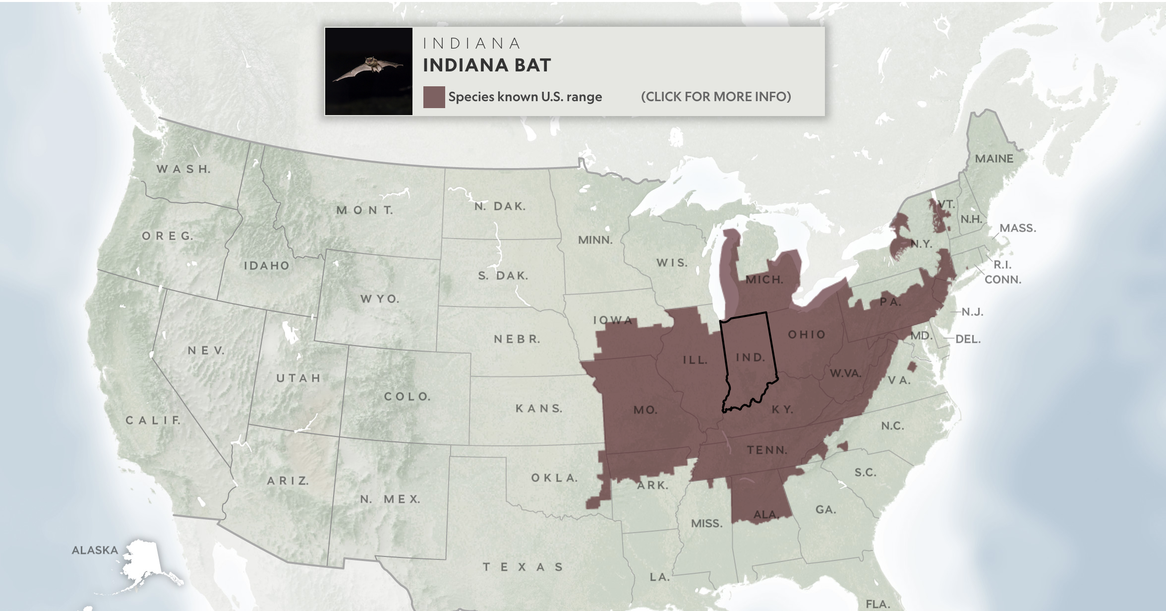
This map was made as an exploratory tool enabling users to learn about a particular endangered species in their home state, or any other state. It was made using a wide set of tools ranging from Blender for the terrain to the Adobe Suite for map design. The map was then rendered in the browser as a series of stacked pngs and svgs. The map highlights the landcover of the US so readers can contextualize the habitats of various states. The design for the mobile version is entirely different to ensure click-ability.