Unorthodox Mapping
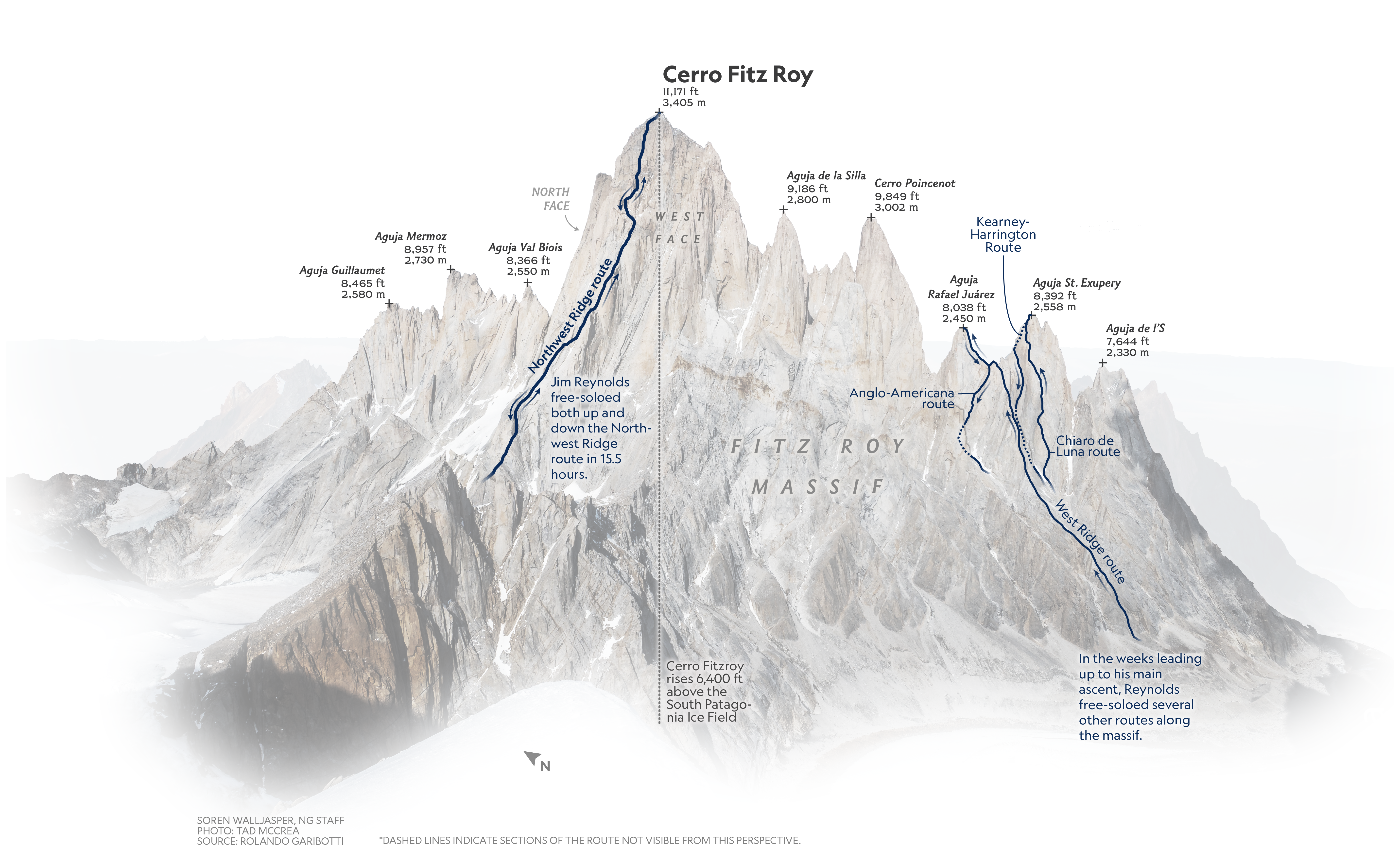
In my time at National Geographic, I have done several maps that illustrate climbers' routes. It's important to show the details of a particular mountain face, and traditional terrain mapping techniques are often too coarse. So I used a regular photograph of the face and generalize it to enhance label legibility and create a clear and informative visual hierarchy for the piece.
Inside the Everest expedition that built the world’s highest weather station
